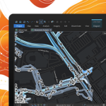
ArcGIS AllSource Connects Disparate Data, Enabling Actionable, Holistic Intelligence for Decision-Makers
Esri Joins Partnership to Help Local Governments Use Mapping Technology to Tackle Equity Issues
Collaboration Brings Multiple Organizations Together to Create First Chief Equity Officer Network
Esri Book Demonstrates How Natural Resource Organizations Can Improve Sustainability, Profits
Managing Our World: GIS for Natural Resources Includes Real-Life Stories with Results to Learn From
Jack and Laura Dangermond Honored with Conservation Visionary Award
Esri Founders Recognized by International Land Conservation Network for Environmental Efforts
Tyler Technologies Named an Esri Cornerstone Partner
Tyler recognized for 20 years of commitment to Esri and ArcGIS technology
Esri Partner Pollen Systems Provides Advanced Agriculture Analytics to Farms using PrecisionView™ Mobile
Mapping aerial imagery captured by drones and satellites together with mobile data helps farms deliver better crop yield and quality.
Esri Recognizes Partners for Achievement in US Federal Government Market
Three Partner Network members were recognized at the Esri Federal GIS Conference in Washington, DC
Esri Recognizes Partners for Innovation and Excellence
Awards Granted for Exceptional Achievement Using GIS at Esri Partner Conference
Ursa Space Launches Python Toolbox API on Esri ArcGIS Pro Software
ITHACA, N.Y., Feb. 13, 2023 /PRNewswire/ — Ursa Space Systems, a leading satellite-analytics-as-a-service provider, has announced the release of a Python toolbox for satellite analytic and data ordering within Esri ArcGIS Pro, a full-featured professional desktop GIS application.
EDF improves collaboration at Hinkley Point C with GIS portal
GIS from Esri UK helps coordinate 8,000 workers on 450-acre site